Talk with @gabrielarl - initial message pasted here:
I applied for a job that I think could be really interesting in WCC and I have an interview this Wednesday. The reason I mention it to you is because one of the things that drew me to this role is the ability to use a Digital Twin of the city to engage and build policy around climate change.
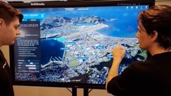
If you had access to a digital twin of the city and probably tons of data, what do you think could be ideas that I could develop?
11:05 AM
I had an idea last year when I was hyped about Unreal Engine about making a climate change simulator which will allow the people to see their city and street in VR as the consequences of climate change pile up. But this is quite broad, I know there is more there
Sea level rise will be an issue in the city, NIWA and the Council already have online GIS resources that can be used to show the affected areas. While everyone gets that the rise is coming, and while the change is serious and permanent, it is also the least pressing in a funny way - since other changes will get us first.
This one came up in the news a while ago - there is a timeline now for insurance companies walking away from coastal properties.
We have a misperception here that because the Dutch hold the sea back, we might be able to. Our situations could not be more different. Aotearoa has crazy amounts of coastline for its size - all the main centers are exposed.
Flooding / Slips
This is the one that doesn’t get talked about enough. We have gotten used to dealing with slips here but the rate at which they happen is escalating. There is a map layer you can use in a WCC map to show slip risk areas but the changes ahead are gonna require a lot more. The warming increases volumes of water in the atmosphere - insurance companies are backing away from the city and I suspect this is a huge driver.
Fires
Pretty low-scale stuff now, but we get bushfires and we have a lot of forests close to residential areas. I don’t know what’s happening in that space here yet, but it’s coming.
Transport
This is huge, of course. Many people are now coming to understand that cars, and the city planning based around them, is the core of the problem. A cyclist weaving through congestion can figure it out easily enough, but people who live their lives stuck in cars don’t get these insights. It’s a weirdly huge leap of imagination that leaves too many people behind. Being able to visualise this stuff, in particular putting people in the space where they can understand that the car set the parameters for all other plans, and the result is that everything is broken as a result.
There are lots of Wellington people working in this area - smart, tech savvy communicator types and they pushed for Golden Mile plan we now have - it could really change the city. At the same time, transport to the Eastern suburbs has been broken for decades, now its dreadful - and partly that’s been due to an inability to agree on Light Rail, or alternatives to it. There’s still a lot of people that want 4 lanes to the planes : i.e. a second road tunnel through Mic Vic. All evidence tells us that will be catastrophic - but people really can’t see that.